Thursday 26 December 2019

ZL3/CB-551 West Russell Range - 26 December 2019

Needing to blow the cobwebs out on Boxing Day, I headed to this one I have had my eye on for a while. It has a new DOC easement track (no bikes, dogs or hunting) through Ben More and Annavale stations, near Springfield.
The day dawned with low cloud but no wind so job was on! There are two car-parks, one for 2WD vehicles and for those with a (proper) 4WD, you can carry on and save yourself 30 minutes walk. I decided not to take Francie's nice new Suzuki along it, very deep ruts and lots of water-filled holes...

The track junction, turn left over the stile.
Steady climb but soon hit the low cloud!
Looking across the valley to Big Ben Range - it's there somewhere!

Looking back down towards North Canterbury

Nearly at the summit. This Link Track could be a good option to stay at Benmore Hut and attempt Big Ben the next day? And it was nowhere near 1.5 hours on to the SOTA summit (1211m vs Sugar Loaf at 1203m)

It's up there somewhere!

Made it. As this summit is not on the DOC easement track, I only popped up there for a photo and VHF contacts
The track wends it's way through the Activation Zone so after working the locals on 2m, I tied my 6m pole to a handy DOC waratah track marker and set up on HF. Pretty average conditions but I did work a few VKs including Allen VK3ARH S2S. Highlight of my day was having Ian ZL3GIG call me on 40m CW S2S - his second ever CW QSO, I suspect he is now hooked :-)
After an hour of operating the Easterly wind came up and was blowing the cloud around and cooling me down. I packed up, ate my lunch and headed down. Take walking poles on this one, the track is quite slippery with scree at times.

Wild pigs have been busy near the summit....
Getting there: 12km past Springfield look for the turnoff to Ben More Station. Turn left and drive down, across the bridge and turn right at the end of the road. There are reassuring DOC signs around. Drive to the car-park and off you go. Track is well marked with waratahs. Private property gates are also well marked!
Time: It's about a 2 hour climb (from the 2WD car-park), 7.24km and 681m height gain.
VHF - good to Christchurch, North Canterbury and Rakaia


Sunday 15 December 2019

Mt Lyndon ZL3/CB-460 14th December 2019

I'd admired Mt Lyndon whilst activating it's neighbours, Trig M CB-536 and the "Lyndon Lump" CB-570. When David ZL3DRN invited me to join him on the inaugural activation of this peak, I accepted eagerly. At 1489m it would be my highest peak yet so a good challenge.

Mt Lyndon seen from Trig M (June 2019)


We agreed to meet early (7am at Sheffield) to beat the forecast North Wester. We arrived at Lyndon Lodge soon after and were walking by 7:40am in calm conditions. Ascent was uneventful and we made good time to the summit, arriving about 9:15am - much earlier than anticipated. We had stopped just below the summit to put on jackets and beanies as there was quite a cold breeze...

We took the mandatory summit photos and admired the spectacular views before setting up.

Me on the summit with Lake Coleridge in the background. Peak Hill CB-542 behind the lake on the left of shot.

Panorama - amazing vistas right around

Looking across to Porter Heights ski-field - Mt Enys CB-152 on the right (with snow)
David is already planning my next big challenge - Castle Hill Peak CB-241
We tried to find a spot out of the cold Nor West wind but it was not possible. Gloves and another layer on and we had the pole set up with David's UNUNTenna and KX2 ready to go.
Let's qualify it on VHF first, it'll be easy... Patchy 4G coverage meant spotting was difficult and we were much earlier than alerted. Fortunately Geoff ZL3QR heard us and we were away, thanks to Geoff, Jim ZL3ND, Gavin ZL3GAV and Rick ZL3RIK. It was nice to hear Oliver ZL3OOC call us too.
By this time, we were feeling very cold despite all our gear - looks like I left it a bit late to put the extra layers on during our ascent and should have carried all my extra merino layers - lesson learned.
As we had the HF antenna set up and knowing John ZL1BYZ would be waiting, David called CQ on 40m SSB. Sure enough, there he was! David saw me struggling to write the contact in his logbook, my hands were shaking uncontrollably and he made the (correct) call to pack up and get moving. David measured the windchill at 3 degrees C from a 20kmh Nor Wester (they certainly aren't warm in the high country!)

We packed down, had a quick snack and set off - "feel like taking the valley route back?" he asks innocently. "There are scree slopes, they are great fun". Feeling better once moving, I agreed. It wasn't until we were committed that he casually mentioned there might be swamps and oh, a waterfall to negotiate too! David was determined to get my shiny new boots dirty!

Nearing the bottom of my very first scree descent - what a rush!!

This sure beats plodding down a track!


Waterfall- spectacular but required a bit of turpentine bush-bashing to skirt it

The scree "surfing" was amazing fun and of course as we got down further, the sun came out! Negotiating the waterfall was tricky and was soon followed by chest-high matagouri, swampy ground and even a bit of beech forest thrown in. A really good way to come down but definitely not for the solo activator - you need someone with you if coming down this way.

A great summit and definitely on my "annual list".

Where: Mt Lyndon via Lyndon Lodge end track
Permission: None needed, Korowai Torlesse Tussocklands Park
Time: 1 hour 40 minutes ascent with stops (1 hour 16 moving time)
Mobile: 4G at summit (Spark) but patchy
Repeaters: all Christchurch repeaters

Monday 18 November 2019

View Hill ZL3/CB-756 Saturday16th November 2019

Ian ZL3GIG describes this as a Champagne summit on Banks Peninsula - I have to agree (but couldn't find the bottle!).

On private land, access is readily granted by the farmer via text message the day before. Even though it's only 43 km away across Pegasus Bay, it's a 100 km drive to get there!
Ian's Blog has all the details you need so check it out.

View across the bay to home!

Forecast was for 25 degrees and light winds, sounds good right?!

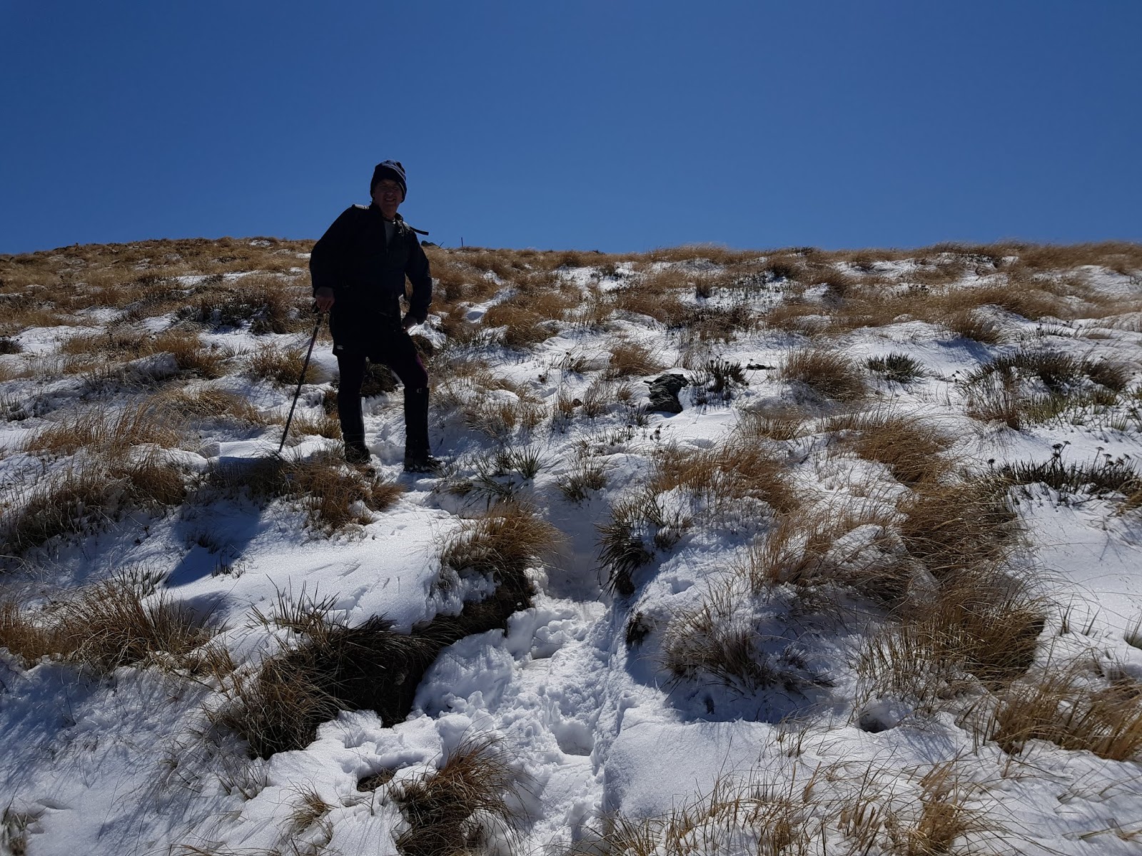
I parked at the sheep yards and started walking. Unlike Ian, I turned left at the strainer post with Number 8 on it and followed the farm track up to where the spur meets the road. Through the gate and straight up the spur to the summit through another gate. No fences need to be climbed on this route (gpx file posted on Sota Summits Track Page) and it's a fairly gentle ascent up the spur. Total walking time from the yards just under an hour. It's a good walk, well within the capabilities of your average SOTA ham.
View of Little Akaloa bay and Kaikoura in the distance from the final gate, just before the summit
Looking South, Mt Pearce on right (with tower), Duvauchelle Peak (centre)


The views from the summit really are spectacular, justifying a panorama really :-)
 The farmers have provided nice sturdy steps to the actual summit!

I was way earlier than expected so work a couple of locals (Geoff and Bill) on 2m but couldn't raise anyone else. Mild panic, the first time I haven't managed to activate on 2m!
The wind was blowing strongly from the North East so I set up the HF antenna pole in the lee of the summit for a bit of shelter. Even so, the gusts were threatening to snap it so I pulled it down again and guyed it (only the second time I've had to do that).

Antenna de jour was a new 66' (20m) endfed inverted vee. 1/2 wave on 40m, full wave on 20m, close to resonance on 30m and 17m and 3 1/2 waves on 15m. Coupled to the radio with a home-made EFHW transformer coupler, it tuned up nicely on all bands with no need for the KX2's inbuilt tuner.

Coupler with antenna (yellow) rubber banded to my pack for strain relief. Counterpoise (top) and choked coax (left).
Antenna running North-South
Fired up on 40m CW and started calling - first contact was Bill again, I still needed 2! Changed to 30m and called, worked Bill again ( still mildly worried!) and then Don ZL3DMC and Allen VK3ARH for #4. Phew! I then worked John ZL1BYZ and Jacky ZL1WA S2S. N7MQ called me on 17m and then Andrew VK1DA for another S2S. I stuck it out until the UTC rollover, worked a few repeat callers and then packed down as the wind was starting to move around to the NW and get really strong.

 The walk down was uneventful apart from having to grab my hat on occasion to avoid losing it and some light spillover rain. It was about 30 minutes back to the car.

Details:
Access permission required from Joanna - 0274557341, send her your name and callsign asking for access to the summit. She's a lady of few words - her reply will be brief!

Drive to Little Akaloa (about 1.5 hours from Christchurch), turn right onto Chorlton Road, Turn right to stay on Chorlton Roand and veer right onto View Hill Road.
Park at the Stock Yards on the right (unless you have a 4WD in which case you can carry on).

Walk (or drive) up the farm road until you get to an intersection with a white strainer post and another post with number 8 beside it. Park here if driving. Turn left and walk up the track until you get to the 2nd gate at the bottom of the spur. Through the two gates and straight up the spur to the summit. There's another gate near the summit.

Phone access: 4G (Spark) OK at the summit
All Canterbury repeaters within range
Walking Time: 1 hour from the stock yards to the summit, 30 minutes descent.


Monday 4 November 2019

Mt Guy ZL3/CB-521 Sunday 3rd November 2019

I'd had my eye on Mt Guy for a while as it hadn't been activated and was down in the SOTA playground that is the Ashburton Lakes area, right above Lake Clearwater.
Weather forecast was for 30+ degrees and westerly winds rising to 50km/h so I set sail from home just after 5:30am. It's a 2 hour drive and I arrived at Lake Clearwater and was ready to go at 7:50am NZDST. Temperature was already 15 degrees and the lake was flat calm.
If you have an SUV, you can drive around the 4WD track right to the footbridge and the start of the track. Do not try it in a sedan!
The DOC estimate was pretty close for me, 1 hour 30 with one break to refuel
After a short walk along the lakeside track, the track to Mt Guy is well signposted on your right.
View of the summit from the start of the summit track
My plan worked out well, climbing in the cool of the morning and on the shady side of the summit. It's an interesting climb with great views behind you, necessitating a few stops to admire it ;-)
Like this one 3/4 of the way up:
Lake Clearwater village with Lake Camp (L) and Lake Clearwater (R)
You can see the track leading around to the head of the lake and the footbridge at the start of the track-proper. If you zoom right in you'll see Francie's Grand Vitara parked just before the bridge. It handled the track with ease. Shame they don't make them any more - I would like one for myself!

Looking to the right of the lake gives great views through to the Rangitata River

Same view but from the summit, Mt Potts on the right
Made it! Summit cairn looking South East
You knew there was going to be a panorama, right?! This is one of my better ones. Click on it to expand. It starts looking South East towards Mt Barossa and Mt Somers and does a full 360 degrees. I always feel blessed that we live in such a stunning environment!


So after txting home (Spark OK at the summit) I got set up with the 2m Slim Jim about 4m up my telescoping mast (bungeed to the last track marking waratah) and the 41' HF endfed antenna at the top. Wind was OK and temperature pleasant. First call on 2m netted Rick ZL3RIK/M (heading to Lake Clearwater collecting squares, lakes and summits!) and then Robin ZL3REW from Rakaia. Surprisingly, I also got Jim ZL3ND in Methven - right through Mt Somers! That was it for 2m so I headed to HF and got my fourth contact from my first CQ on 40m CW, thanks John ZL1BYZ! I worked my way up the bands/modes and picked up all the regular chasers, thanks all! 20m CW was no good due to QRM from the North American SS contest, a good sign! 17m CW produced NW7E in Oregon and 30m VK7CW. I shot back down to 60m to see if there were any locals about - worked John ZL1BYZ again with good signals and then called it quits as both the wind and temperature were getting up.
UNUNtenna clipped to pack with KX2 and homebrew thigh rest. belt around thigh, radio velcro attached.
Due to the predicted weather, I had trimmed down the pack contents in favour of more water. Used the KX2 internal battery only, no problems at all. I will do that more often. Thanks to John ZL1BYZ and Mark ZL3AB for the spots and facebook updates, much appreciated.

Getting there: Head to Lake Clearwater via Mt Somers township, about 2 hours from Kaiapoi, 1.5 hours from Christchurch. Take any of the streets to the right down to the lakefront and you'll find the start of the track. If you have an SUV with good ground clearance and HD tyres, you can take the 4WD track to the trail head. Otherwise, park here and walk. The 4WD track and the trail itself are well marked with orange waratahs.

Permission: None needed, Hakatere Conservation Park
Trig marker: none, rock cairn at summit
Cell coverage: Yes (Spark) patchy but OK right at summit
Repeater access: Oops! Didn't try but I doubt it!
Time to the top: DOC says 3 hours up. Driving around to the lake head saves a bit of walking. It took me 1 hours 30 min with a stop for snack. 50 minutes down (walking poles recommended).
Distance traveled: 5.6km with 640m of height gain


Sunday 27 October 2019

Mt Alford ZL3/CB-568

I'd been keen to get down and do some of the Mid-Canterbury summits for some time. The easement to access Mt Alford is closed for lambing 20 September until 20th October (inclusive) so the weekend after Eastfest (in Methven) was selected. Edit Sept 2020 - the easement closure is now 1 Sept - 30 Sept, check DOC website before you go!
Saturday dawned fine and clear with North East winds forecast to increase throughout the day.
It's a 1.5 hour drive from home via the spectacular Inland Scenic Highway (SH72).

I arrived at the carpark and started walking at 8:40am
The track is described as Moderate, lots of rain the previous few days left it boggy in places but easily navigated. As you climb through the beech forest (fantastic birdsong from the Bellbirds), glimpses of the plains show through until you reach the alpine tussock tops.

Fenced area to the left is Mt Alford Station, repeater sites and observatory, track climbs to ridge and along to summit on right
The track crosses areas of volcanic rock with many skinks and grasshoppers sunning themselves on the warm rocks.The summit itself looks like a volcanic boulder field - remnants of a very active volcanic area 89,000 years ago. They make great antenna supports :-)

Pole jammed between two boulders with antenna wire to the operating site. Mt Hutt in the background (North)
The larger boulder in the next photo came in handy (to stand on) when I heard Richard calling from Mt Barossa, the other side of Mt Somers and Mt Winterslow
Mt Somers (left) and Mt Winterslow (right)
I think the radio signals (on 2m) refracted over the ridge - anyway, it worked!
Radio-wise, it was an interesting activation. No Australians (first time that's happened). Worked S2S: Mark ZL3AB on Dunblane (Hanmer) on 10m CW, Richard ZL4FZ on Mt Barossa (2m), John ZL1BYZ on Puketutu  and the gang of loyal chasers as well. Also worked David ZL3UDH in Timaru (2m). Thanks everyone!

Wind was reasonably strong but not too bad. I packed up and headed down about 1:30pm. On the way down I met an 88 year old gent with his son climbing up, Dad apparently does the walk every couple of days - he looked in great health!

I'm a sucker for a panorama, especially with breathtaking scenery like this, open the photo by clicking and pan (if necessary) using your mouse. The panorama is 360 degrees, starting and finishing at Mt Hutt and panning across the Canterbury Plains.


Getting there: SH72 to the Mt Alford car park via Alford Settlement Road

Permission: Easement access and DOC conservation land so none needed. Easement closed 20 Sep to 20 Oct each year inclusive. EDIT Sept 2020  - the easement closure is now 1 Sept - 30 Sept, check DOC website before you go!

The track is well marked.
Trig marker: none, but there is a cairn and wooden pole.
Cell coverage: Yes (Spark)
Repeater access: all Canterbury repeaters.
Time to the top: DOC says 3 hours up. It took me 2 hours 40 min with stops. 1 hour 30 minutes down with a couple of stops again.
Distance traveled: 8.7km with 713m of climbing


Wednesday 9 October 2019

Mt Oxford ZL3/CB-500 6th October 2019

This was to be my highest and longest climb yet attempted. 13.2 km (round trip) and 940m height gain. I was glad to have David ZL3DRN along with me. David is an experienced mountaineer and relatively inexperienced ham. As it turns out, our skills complemented each other nicely!

View of the summit (snow covered high point left)  from near the start of the track
Sunday dawned clear and frosty after snowing in the high country the day before. We met at the Coopers Creek track start point at 9am and set off.

David ZL3DRN among the snow tussock
I did my usual trick and set off like a rocket, only to run out of legs before the final climb to the summit. David recognised the signs and called a stop to refuel with some protein snacks. The photo above shows the terrain for the top half of the climb.

Made it!
After a good break and me feeling much better, we set off for the summit and boy was it a welcome sight! 3.5 hours to the top (DOC says 3-4 hours so I don't feel too bad).
Operating 2m from a cairn on the summit. Waimakariri river in the background.

We had a quick break at the summit and started on 2m to work the locals before the UTC rollover. This went well both of us working S2S with Mark ZL3AB on Carews Peak, John ZL3MR on Trig M and Ian ZL3GIG on Mt Pleasant as well as all the loyal local chasers. We then set up on HF using the summit sign to support the pole. By this time it was 0003z and time to work the locals again for the new UTC day. Once complete, we went to 40m and worked Warren ZL2AJ who kindly spotted us (poor Spark coverage on the summit). John ZL1BYZ on ZL1/AKL-014 and Soren ZL1SKL on ZL1/ML-002 called for S2S and then we worked Jacky ZL1WA, Andre ZL1TM and Richard ZL4FZ.
Tried 20m but too many contest stations and I was staring to get cold (we were well above the free air freezing level of 1000m) and the predicted Nor' Easter was coming up.

A highlight of the day was being buzzed by a glider - he was only about 50m away from us as he surfed the ridge thermals and was waving at us from the cockpit as he whooshed past!

Packed up at 0030z and we headed down to a spot out of the wind for lunch.


Me on the descent after our lunch stop

This is a great walk and a very popular summit. We met about 7 other parties during the day.
It's not one to be taken lightly and, if tackling it in the summer, head up very early in the morning to avoid the heat (and carry plenty of water). From personal experience, pace yourself on the first bit and conserve energy for the steep bits further up!!

My thanks to David for his advice, coaching and company. A very enjoyable trip which I look forward to doing again next year.

Getting there: Drive to the Coopers Creek car park which is on Mountain Road near Oxford.
Permission: easement access and DOC conservation land so none needed. The track is well marked.
Trig marker: none, but there is a sign saying Mt Oxford 1364m which you can bungee a pole to.
Cell coverage: Yes but patchy (Spark)
Repeater access: all Canterbury repeaters.
Time to the top: DOC says 3-4 hours up. It took me 3 hours 30min with many stops.
Distance traveled: 13.2km with 940m of climbing

Sunday 22 September 2019

"Lyndon Lump" ZL3/CB-570 21 Sept 2019

Another fantastic spring day in Canterbury so off we set for Lake Lyndon in the Canterbury High Country. This hill sits at the South East end of the lake and is adjacent to Trig M where Ian ZL3GIG was headed. 15km away is Peak Hill and John ZL3MR. There was just the small matter of Red Hill in the way!
Looking to the Rakaia. Lake Coleridge and John ZL3MR behind the snowy hill!
 I was nice and early so got everything set up including the 2m Slim Jim to give the best chances on 2m. Terrain/Path predictions showed only line of sight to North Canterbury however this was soon put to rest. I worked Ian and then had good signals from Mark ZL3AB and Bill ZL3NB in the city and Geoff ZL3QR in Rangiora - 4 contacts and jobs a goodun! Also worked John through (or around) Red Hill and Rick ZL3RIK who was mobile, grid square chasing.

Christchurch is right through the centre of this view - edge refraction maybe?

Looking North East up the lake with Trig M on right, Foggy Peak and Castle Hill centre
HF conditions were great although with no cell coverage at the operating position, it was tricky to know where everyone else was and get spotted. Found John ZL1BYZ (Pirongia) on 40m CW and then Warren ZL2AJ spotted me on 40m SSB. Once I had worked the ZLs, I went to 20m CW (so the RBN could do the spotting) and worked a string of VKs and also two W7s which was a nice surprise.
Tried 17, 15 and 30m without much luck. Waited for the UTC rollover and worked all the locals again and John ZL1BYZ. A good haul, 32 QSOs, 6 S2S (couldn't hear Dan or Steve).


Take your fishing gear, we spotted these guys cruising the shallows right beside the track on the way out!

 John, Ian Rick and I had arranged to meet at Springfield for coffee and debrief on the way home, as is our custom. Happy to recommend the Highway Cafe in Springfield - nice food, good service and great coffee. We had a really good debrief - the highlight for me was Ian's face when Francie commented on "the very different ground plane effect between river flats and summits" (In a previous career she earned an NZCE Telecomms).


This is a nice easy 4 pointer - about an hours climb but take a walking pole for coming down, lots of loose material to negotiate. Andrew has loaded a GPS track on SOTA Maps.

Track is unmarked, follow the old 4WD track up to the ridge, then you'll see the summit post

 Andrew's directions to get there are perfect, only thing I would add is that the road in to the parking area off the Lyndon Road is a bit gnarly - deep potholes full of water. If you haven't got good ground clearance, park at the turnoff and walk in. It's not far and you may get a glimpse of the fish!

Monday 16 September 2019

Peak Hill ZL3/CB-542 14 Sept 2019

 This hill is situated on the South side of Lake Coleridge. It qualifies for the winter bonus and was previously un-activated. My original plan was to activate on Saturday 13th for the Andrew White Memorial but it wasn't to be. The High Country forecast was poor with snow down to 800m (I would be at 1240m...) so I postponed to Sunday 14th. The other Canterbury activators did too.
Sunday morning dawned just as bad in Kaiapoi but the forecast was good so off we set. The drive to Lake Coleridge is spectacular - you run out of superlatives long before you get there!
The weather on arrival was perfect and the hill was largely clear of snow, just a few patches visible near the summit.
View from the Intake Road. Peak Hill on the left, lower slopes of Kaka Hill on the right.


 Access is via a well marked DOC track with the first bit an easement across farmland.
 Once you enter the Conservation Area, it's a steep grunt straight up to the ridge.
From there you walk along the ridge and, after several false peaks, end up at the summit


Traditional cairn at the summit. There's also an excellent information board

As soon as I set foot in the activation zone, I heard activity on 2m and worked Mark ZL3X on Moorhouse Range, Rick ZL3RIK on Carews Peak and Robin ZL3REW in Rakaia (the only one I was expecting to work on 2m!). Once I arrived at the summit, I worked Jim ZL3ND in Methven and I had my four contacts, a new peak activated!

Looking East towards Rakaia, the only line of sight path!

South East towards Mark on Moorhouse Range. How we worked on 2m is beyond me!

I set up HF with the endfed antenna "pointing" North. With no wireless broadband available, I hit the normal watering hole frequencies and worked John ZL1BYZ on AK-018 and John ZL3MR on Saddle Hill. Warren ZL2AJ worked me and kindly spotted me on Sotawatch. That brought a flurry of regular Chasers and I then changed to 20m for VK. No callers on SSB so I went to CW in the hope that the RBN would pick me up and alert. It must have as I worked a flurry of VKs. Caught up with the other activators again after 0000z and most of the locals. Last contact was at 0025z and I commenced packing up as the wind was rising and temperature dropping as was forecast.

Looking North. Very little snow thankfully and a stunning vista!


This is a really spectacular summit and highly recommended for the reasonably fit activator. Be well prepared, this is the Canterbury High Country and this hill is extremely exposed to weather.

Getting there: EDIT 5th Sept 2020:

"drive through the Lake Coleridge village and turn onto Algidus Road to the carpark, about 9km."

This road from the village is a forestry road and can be closed. A better route is to turn off at Homestead Road (before the village-signage for Peak Hill) and then left into Algidus Road.

 Follow the markers across the easement and up the track. It's about 1 1/2 hours to the top. Walking poles (if you have them) are recommended for the descent, the track is on the South side and pretty slippery.

It's worth stopping in at the village on the way home to check out the power station, fascinating information boards and displays.


Tuesday 3 September 2019

ZL3/CB-617 Un-named summit West of Mt Thomas

Another winter walk on a fine day. This summit is reached after a 2 1/2 hour climb through forest and native bush. It's quite a challenging walk - a reasonable level of fitness is required.
John ZL3MR came with me on this one and we used his HF gear to try it all out.
 There were a number of trees down along the track and it was quite muddy in places.

 John operating HF in the background, antenna pole bungied to the summit marker (waratah) in the foreground. Yes, that's snow on the ground!

 View towards Mt Oxford with the Southern Alps in the background. Not a bad day for the day day of winter!
Panorama of the Canterbury Plains with the Port Hills in the background. It's a tough walk but well worth it!

We made a good number of contacts on 40/20m SSB and 2m FM. Highlight was working Tony VK3CAT summit to summit on an 8 point Victorian mountain! Other S2S with Rick ZL3RIK, Ian ZL3GIG and John ZL1BYZ.

I will add this one to my annual must-do list. It's quite a grunt but well worth the effort and quite close to home. It's 20m higher than Mt Thomas - hence why it is designated as the SOTA peak.