Weather forecast was for 30+ degrees and westerly winds rising to 50km/h so I set sail from home just after 5:30am. It's a 2 hour drive and I arrived at Lake Clearwater and was ready to go at 7:50am NZDST. Temperature was already 15 degrees and the lake was flat calm.
If you have an SUV, you can drive around the 4WD track right to the footbridge and the start of the track. Do not try it in a sedan!
 |
| The DOC estimate was pretty close for me, 1 hour 30 with one break to refuel |
 |
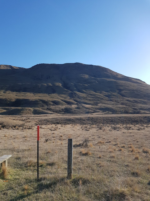
| View of the summit from the start of the summit track |
Like this one 3/4 of the way up:
 |
| Lake Clearwater village with Lake Camp (L) and Lake Clearwater (R) |
Looking to the right of the lake gives great views through to the Rangitata River
 |
| Same view but from the summit, Mt Potts on the right |
 |
| Made it! Summit cairn looking South East |
So after txting home (Spark OK at the summit) I got set up with the 2m Slim Jim about 4m up my telescoping mast (bungeed to the last track marking waratah) and the 41' HF endfed antenna at the top. Wind was OK and temperature pleasant. First call on 2m netted Rick ZL3RIK/M (heading to Lake Clearwater collecting squares, lakes and summits!) and then Robin ZL3REW from Rakaia. Surprisingly, I also got Jim ZL3ND in Methven - right through Mt Somers! That was it for 2m so I headed to HF and got my fourth contact from my first CQ on 40m CW, thanks John ZL1BYZ! I worked my way up the bands/modes and picked up all the regular chasers, thanks all! 20m CW was no good due to QRM from the North American SS contest, a good sign! 17m CW produced NW7E in Oregon and 30m VK7CW. I shot back down to 60m to see if there were any locals about - worked John ZL1BYZ again with good signals and then called it quits as both the wind and temperature were getting up.
 |
| UNUNtenna clipped to pack with KX2 and homebrew thigh rest. belt around thigh, radio velcro attached. |
Getting there: Head to Lake Clearwater via Mt Somers township, about 2 hours from Kaiapoi, 1.5 hours from Christchurch. Take any of the streets to the right down to the lakefront and you'll find the start of the track. If you have an SUV with good ground clearance and HD tyres, you can take the 4WD track to the trail head. Otherwise, park here and walk. The 4WD track and the trail itself are well marked with orange waratahs.
Permission: None needed, Hakatere Conservation Park
Trig marker: none, rock cairn at summit
Cell coverage: Yes (Spark) patchy but OK right at summit
Repeater access: Oops! Didn't try but I doubt it!
Time to the top: DOC says 3 hours up. Driving around to the lake head saves a bit of walking. It took me 1 hours 30 min with a stop for snack. 50 minutes down (walking poles recommended).
Distance traveled: 5.6km with 640m of height gain

