Despite being named as a hill, Red Hill in the Korowai-Torlesse Conservation area is a decent mountain at 1641m. Dave and I have been planning this circuit for a while but needed a suitable weather pattern to turn up. Saturday 6th May looked good so off we went. An early start was in order to make the most of the weather window and get back to Springfield by 4pm for a coffee and debrief!
I left home at 5:30am to pick Dave up in Sheffield at 6:20am and we were at the start point on Lyndon Road ready to go at 7am. No headlamps needed as the spectacularly full moon was really bright. We made good time up the valley and even found some size 15 boot prints left by John ZL3MR the previous weekend!
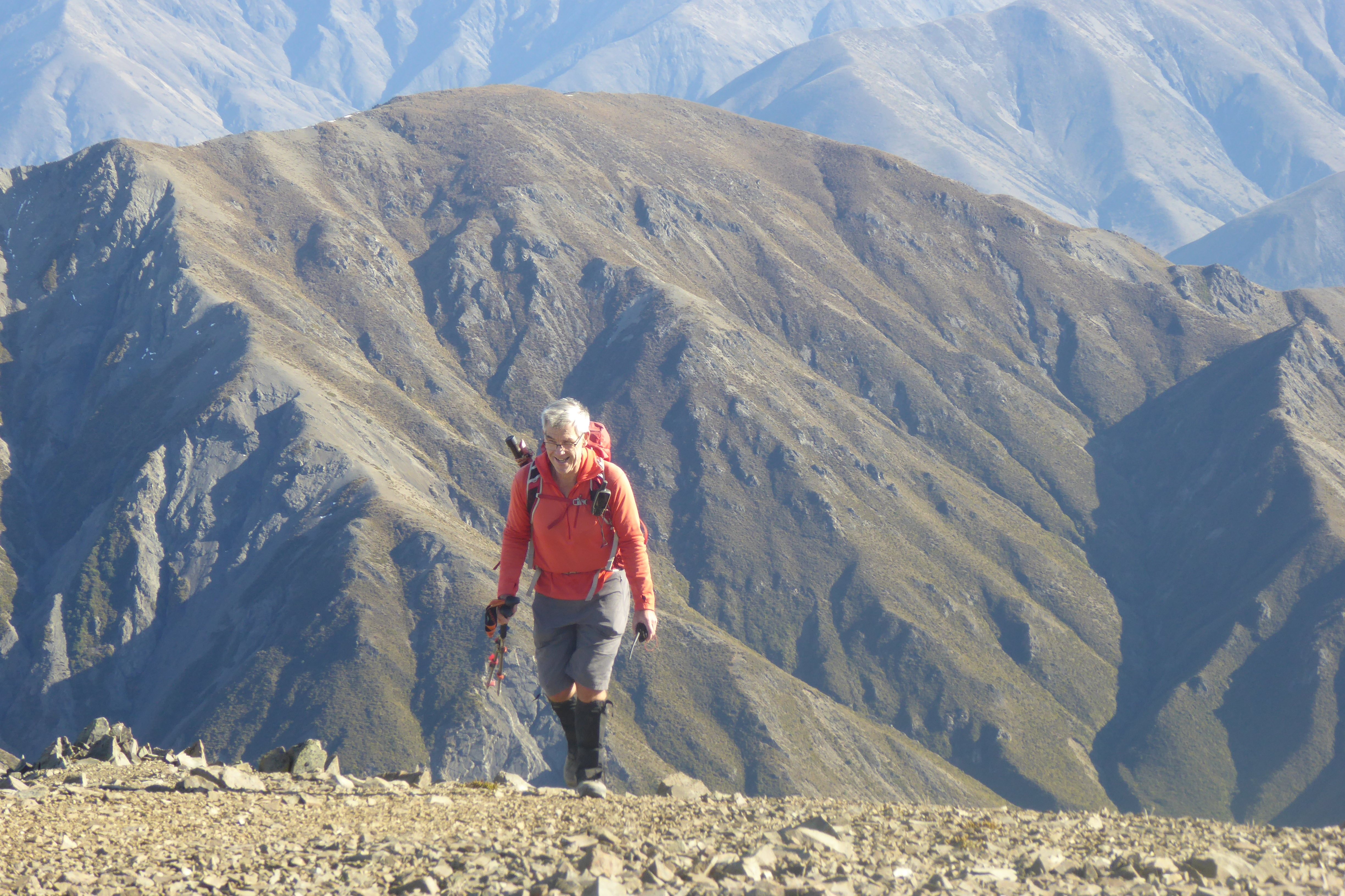
 |
| Heading up Red Hill, spectacular views. |
Arriving at the summit 25 minutes earlier than our alerted time, we got everything set up quickly and were on air at 9:42am NZST. As is our standard practice, Dave started on 40m and me on 2m. We soon had our required contacts (including Summit to Summit with John ZL3MR on Cloudy Hill ZL3/CB-474) and had worked all the usual Chasers. The Nor' West wind was quite strong at times so, once our alert time had passed, we packed up quickly and headed off.
The transit around the ridgeline to Mount Lyndon is a really nice walk with tremendous views either side but very exposed to the wind - gloves, hats and windproof layer were the order of the day. Near the end we spotted another tramper catching us up rapidly - "Hope he's not a 70 year old"! Just after passing the scree we would use later to descend, he caught us up, a young German. Relief!
 |
| Looking back from Mt Lyndon to Red Hill (top-centre) |
About this time, we saw John (with brother-in-law Robert) had arrived on their second summit ZL3/CB-469 which is adjacent to Mt Lyndon. We hustled on and arrived at Mt Lyndon ZL3/CB-460 35 minutes early, just before noon. Getting straight onto 2m, we worked John and a few others prior to the UTC rollover at noon (0000z). HF followed where Dave worked a nice pile of VK WWFF Hunters and Rick ZL3RIK at Arthurs Pass National Park. Again, we made sure we stayed on-air until after our alert time had passed before packing up about 12:40pm and retracing our track back to our scree for the descent.
Weather has been quite wet all summer so the scree and underlying soil was nice and soft (very important for clapped out knees). It was a very rapid and enjoyable descent down to our usual lunch point at the bottom of the scree before tackling the waterfall sidle and a bit of scrub bashing down to the valley floor. When coming off Mt Lyndon, we normally turn left at this point and head over the saddle to the Lyndon Lodge but this time we carried on down the valley to join up with our morning track and back to the car.
 |
| Looking down the valley from our lunch stop |
A great walk and very enjoyable day with 10 SOTA points as a bonus.
Note that much of our route was over Brooksdale Station land - thanks to Stu for his generous permission (see Dave for more info).
 |
| Circuit is clockwise, Red Hill on left, Mt Lyndon on right |
Stats:
18 km of walking with 1300 m of vertical. 8 hours for whole the trip including two 30 minute activations and a 30 minute lunch stop.
2m/70cm coverage of Canterbury excellent from both summits.