Monday, 8 January 2024

Mt Rochfort Conservation Area and Lake Rochfort - New Years Day 2024

 New Years day 2024 dawned fine and all was ready for my planned Mt William SOTA activation on the West Coast. Just before I was due to leave camp, I happened across a news item that said the access road to Denniston had been closed by a slip and people were being rescued from the other side... 

I still went to check, not what you want to see...

Time to quickly re-plan, drat, no other accessible SOTA peaks in the area so it would have to be something else. I spotted Lake Rochfort in the Mt Rochfort Conservation Area and decided that would do.

It's a hydro lake, the walk up takes you via the 4.2 MW powerhouse/tail race and up the historic access track, complete with Totara steps in places.

Tailrace


Old Totara steps still in good condition

It's a nice walk and you soon arrive that the lake to be greeted with a shelter and picnic table! Well, it would be rude not to use it so I got set up using the shelter to bungee my pole, turned on the radio to be greeted with S9+ of QRM (from the solar regulators I expect). 

Too good to be true...

Quick pack up and head to the SE end of the lake, hopefully quieter there. Only marginally as it turned out. Tweaked the KX2 nose blanker and away we went.


Given that I had alerted for a SOTA summit, I didn't want to cause confusion by calling CQ so just chased the activators on SSB each side of the UTC rollover.

After getting John ZL3MR on his Goat summit (and fortuitously giving him his 4th contact to qualify as a Goat) I packed up and headed back to the car. Not quite a SOTA summit but a nice walk on a good day.

Good walk, 6km and 426m vertical, lots of SOTA summits that are easier than this!

Access is a small white sign on left about 20m before the bridge on Powerhouse Road (about 7km North of Westport). There's a parking area on the South side of the road. The track is well marked/used.

Cell service was fine with Spark/Skinny

ZL3/WC-638 Un-named summit near Reefton

 This is another one of Andrew ZL3CC's First Activation summits, in fact it hadn't been activated since he did it. We (like many!) have always driven straight through Reefton, however this year, we decided to stay a few nights and have a look around. The first town in NZ to have reticulated electric power, what's not to like?!

Thursday 28th Dec 2023 dawned warm and fine, the starting point at Blacks Point is only 3 minutes away from the camping ground and I was there and ready to go at 8am. Taking the left track directly up the spur, I was soon sweating out the Christmas cheer. The initial part is steep but well benched. Soon the exotic forest is left behind and we are into the native, lots of predator traps and wasp bait stations and the abundant birdsong proves their worth. I heard what I thought was a Kaka and sure enough, on the way down later, I was lucky enough to have a close encounter with one - very special! 


The remains of old goldmines are preserved as if they had just been abandoned. Very interesting relics scattered around.


I arrived at the Horse Whims turnoff which Andrew determined was within the AZ, I agree. However, like Andrew, I climbed up through the bush towards the summit a little to be sure and to get away from what looked like a well-used track. Another good call as two parties went through while I was there (but they were unaware of me).

Unusual operating surrounds for us Cantabs!

The bush is fairly thick so the EFHW wended its way through convenient branches then up to the top of the 6m pole and down again to a convenient trunk. I spotted a few wasps so was very careful where I walked...

Yellow antenna wire looped around the trees at head-height

The KX2 tuner made short work of finding a match so it was time to get out a spot or National System repeater call. No service from either, I think the Greymouth Nat Sys node has moved since Andrew used it as I could not access it at all. OK, call CQ on 7032 kHz CW so the RBN can let people know I am about. I then went to 7090 kHz and it worked, I worked Phil ZL3JD, ZL3PEA, ZL4AB and then Rick ZL3RIK who spotted me and it was all on! I got Dave ZL3DRN on his summit then worked my way up the bands. No VKs but Chris F4WBN, NW7E and WB6POT in the log on 15m CW. Nothing happening on 10m.

Expecting John ZL3MR and Nick ZL3NLA to arrive on their summit at 11am, I went back to 40m SSB and waited. As the day warmed up, the wasps were getting more active so I was keen to get moving. Once they were in the log, I packed up and headed down. Home to Reefton in time for lunch! There are several loop options to get back, the Konini fork would bring you right back to Reefton (if someone dropped you at the start point).


Want a Bach right at the carpark of a SOTA track?!


Time: 1 hour 15 min to the summit. 4.2 km with about 500 m vertical gain

Cell: No reception

Repeaters: None available

Trig: none, the summit is not even noted as a point on the topomap!


Mt Rochfort ZL3/WC-576

During our Christmas/New year break on the West Coast, I decided to do the first SOTA activation of this mountain, visible from Westport.

The summit is accessed from the Denniston plateau and could be a drive-up given a suitable 4WD vehicle. Not sure if permission would be needed but there is no signage and Kordia have  a substantial site at the top. The road is pretty good with just a couple of gnarly bits. Anyway, it's a nice walk from the Whareatea Road turnoff. I drove up a bit to find a nice parking area between the two sets of beehives. A very pleasant walk to the top with mostly easy grade. Plenty of things to look at on the way so walking is a good option.

Weather had been wet and windy but there looked like a bit of a window to exploit, Metservice forgot to notify the mountain though! It was claggy and windy at the top with intermittent showers. I set up just to the South of the tower with some protection from the wind. A convenient waratah supported the pole and the EFHW wire snaked around and over the bluff. There was no interference evident from the large commercial equipment on the tower, mostly microwave.


EFHW snaking around the bluff

I had worked one of the locals via the Westport repeater whilst driving to the start but after a couple of calls on the Wesport repeater from the summit, had no takers on 146.5 MHz. I wonder if people have forgotten how to use simplex?

HF was playing nicely and I soon had the loyal ZL chasers in the log on 40m SSB including S2S with Nick ZL3NLA on Trig M. I then headed up the bands and worked Scott ZL1KB on 20m; WB6POT, F4WBN and JH1MXV on 15m CW and K7SS on 10m. Cold and damp, I headed back to 40m to await a chance to work Dave ZL3DRN on Snowy Peak for another S2S. Duly achieved and also Paul ZL3PA who was having trouble hearing me earlier. A good haul so I packed up and headed down to find a sheltered spot for lunch and then back to the car.

The Escarpment, drops away pretty quickly!

This is a really nice summit, I'm keen to come back and do it on a good day to see the views! The abundance of minerals is obvious in the track metal and the walls along the side of the track, coal seams everywhere!


Getting there: Turn off the highway at Waimangaroa and drive up to Denniston, turn right onto Whareatea Mine Road and just before you reach the locked gates, turn right. Find somewhere to park and follow the 4WD track to the top.

Turnoff to the summit road

Permission: Not required Mt Rochfort Conservation Area

Distance ~4km to the top with ~400m of vertical gain. About 1 hour

Repeaters: Westport 675 accessible, Greymouth not. No local contacts.

Trig: Yes and substantial infrastructure towers and buildings

Cell - 4G on Skinny/Spark


Sunday, 8 October 2023

Snowy Peak ZL3/CB-663

 Thanks to Phil ZL2VTH for alerting us to this gem - hidden in plain sight for the last 7 years!

Snowy Peak is on private farmland, Washpen Falls. The owners have put in a very nice bushwalk loop track through the native bush to the falls - access fee is $10/adult and worth every penny. You need to contact them via email to request approval to deviate off the track and head up to Snowy Peak - email: walk@washpenfalls.co.nz 

View East, following the Rakaia river to the the Pacific Ocean

They are very accommodating with this and it's a good farm track all the way up to the summit.

I set off on Sunday morning solo as my normal buddy recovered from COVID. It's about an hours drive from Kaiapoi if you don't forget that Washpen Road is a loop road and the second turnoff is the one you want, not the first! After a very scenic detour I arrived at 9am, paid my $10 in the honesty box and set off.

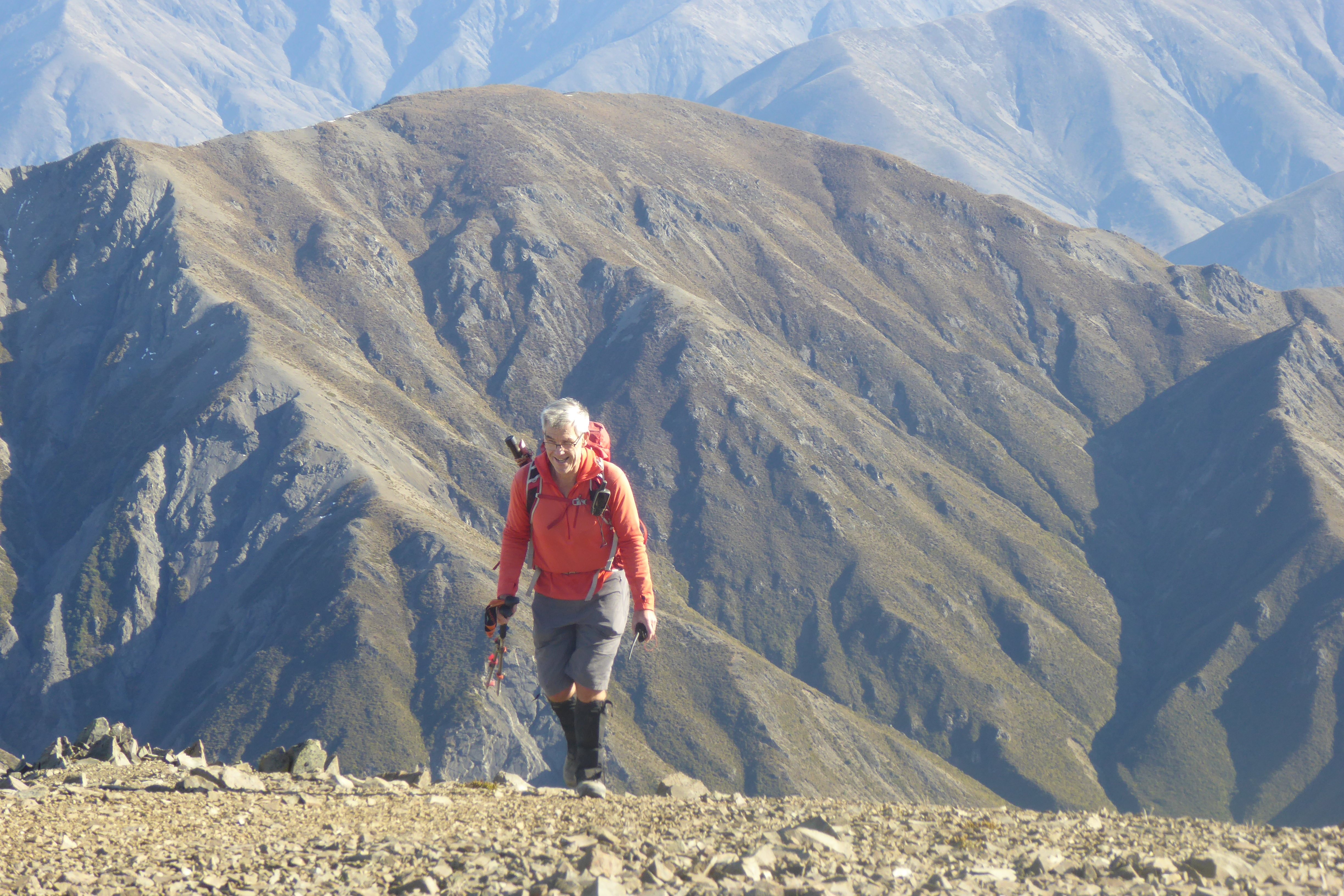
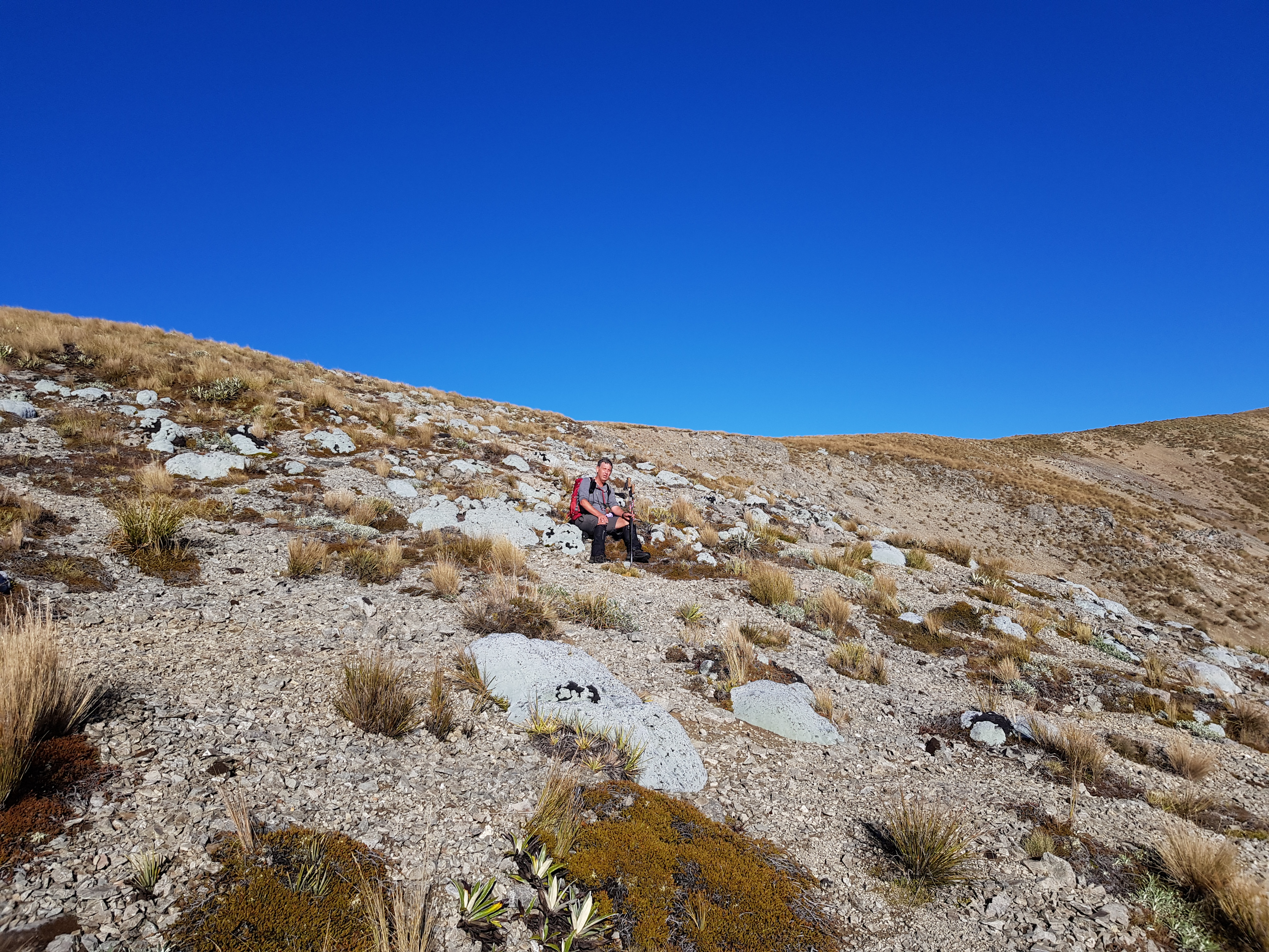
The track climbs steadily through native and exotic forest with some interesting bits under limestone bluffs. Reaching the high point, there is a walking gate, if heading to the summit, don't go through the gate but turn right and follow the fenceline - after about 50m you'll come to a sign pointing up to Snowy Peak - just follow the 4WD track from there. Note that there is a very enticing false summit with a pole mounted on it and a blue PVC barrel that contains an old (drowned) TV distribution amp. This is not the summit, carry on down through another saddle and up to the actual Snowy Peak summit at Pt951m - it's the most northern part of the ridgeline.

From the Snowy Peak summit looking South (over the false summit with pole)

There are remnants of an old fence on the summit with a handy strainer post to tie the pole to. As I was early, I took my time setting up to get a well performing setup with the EFHW Inverted Vee antenna ends well above ground - this would pay off later.

EFHW and 6m pole tied to strainer

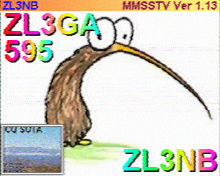
I started up on 2m FM - 30 minutes before my alert time and had four in the bag pretty quickly - always a relief no matter how many times you do this! Four more on 70cm and that's another summit activated on this under-utilised band (try it, signals are usually stronger than on 2m). Then it was time to hit 40m SSB for our loyal local (NZ) Chasers and a QSY to 20m SSB to work John as VK4/ZL3MR. As I signed from John, a very strongly accented call from Chris F4WBN and we completed a nice QSO - I wasn't sure he even owned a mic! I then saw our old mate Adam K6ARK spotted on 15m CW so off I went, I can hear him (with a nice pileup)! "ZL3GA S2S ZL3GA S2S" a couple of times and back he came, much stronger now. We completed an easy S2S even exchanging summit references. Talking later via Messenger, he tells me he has made a portable 15m Moxon complete with rotator, that explains the increased strength and easy QSO!

I found a clear 15m frequency and called CQ - "F4WBN" pops up with a good signal (and again later on 10m!) then several more Japanese and North American stations (CA, AZ, OR worked).

I remain sold on this antenna - 20m of Sotabeams lightweight wire with a 64:1 Owen Duffy designed small efficient matching transformer and 2m counterpoise rigged as an inverted vee using the Sotabeams Tactical Mini (6m) pole. It's resonant on 40/20/15/10m (with no traps or links to change) and it certainly pulls in the DX!

I don't normally post my log but this is a beaut (and besides it shows I CAN use a mic!). Observant readers will note a couple of Kiwi callsigns in there you might not expect to see on CW - Thanks Kevin and Scott, love your work, keep it up!


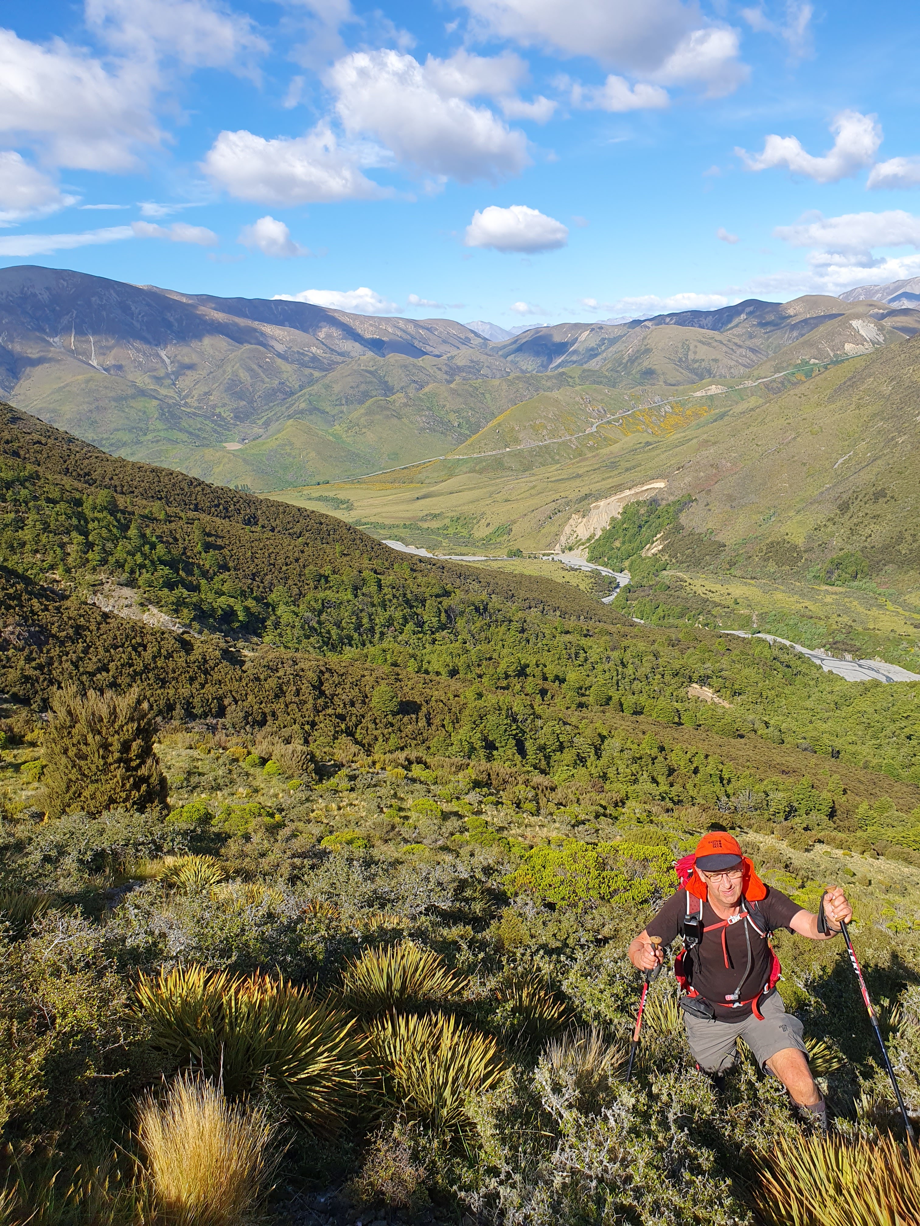
As I had to be back home in time for family dinner I set off down at noon, intending to complete the rest of the loop. I am very glad I did - the track is well marked and has steps/boardwalks in a few strategic (sensible) places. The falls themselves are very nice and I can't think where I have heard more Bellbird song - magnificent.

Armchair Falls

Getting there: Take the Inland Scenic Route, through Coalgate, Glentunnel and Glenroy, turn off onto Washpen Road (the 2nd time it meets the highway!) just before you get to Windwhistle. After a short distance (~400m) turn left into Washpen Falls and drive to the end of the road where there is an old woolshed/office. Park here, pay your $10 and set off.

Permission: Working farm - email or call prior to request permission to walk up to Snowy Peak

2m: great coverage to Christchurch city, North, Mid and South Canterbury

Time: 1 hour to summit

Wednesday, 26 July 2023

Whakapoungakau ZL1/BP-152

Our annual visit to visit family on Whakatane allowed a day for SOTA I chose one that Warren ZL2AJ had documented back in 2020 - Whakapoungakau ZL1/BP152. It's situated up in the cluster of lakes near Rotorua, about an hours drive from Whakatane. Francie and I set sail on a fine late-July morning and were soon at the start point, Okataina Outdoor Education and Recreation Centre where there is plenty of parking. Francie was going to stay at the car, have a look around and catch up on some reading so this was not to be a long activation.
Starting point for the Western Okataina Walkway

The track starts through a ceremonial gateway and is well formed and marked. Considering the amount  of rain this area has had lately, it's in great order with no bogs. There were a few Tui calling, right around the Education Centre.

Impressive tree specimens and a nice track


Glad I wasn't here when this big fella came down!

The route to this summit follows the Western Okataina Walkway to the junction (50 minutes) and then up the Whapoungakau Summit track (17 minutes). The SOTA summit at 762m is just beyond the trig but is bush-clad. The trig at 758m is well within the activation zone and is a very nice operating site with clearings, bush and trees to tie antennas to.
Looking North over Lake Rotoiti


Operating site just in front of the trig

As we flew this trip, I had brought my 5m Carbon fibre telescoping pole, EFHW and KX2. I quickly got set up and tried a 2m contact with Warren ZL2AJ who was teaching a Hamcram at Hamilton. This didn't work out but we soon made contact on 40m with his students listening in - a great opportunity to demonstrate what we do!

I had good signals within ZL on 40m and across to Australia and Japan on 20m
A couple of Summit to Summit contacts with Dave (Sugarloaf ZL3/CB-860) and John (Mt Pleasant ZL3/CB-822) rounded out a very pleasant morning. 
A quick chat with a mountain biker who had arrived at the summit and conscious of Francie sitting down at the car, I packed up and headed down in time for lunch. 

A really nice place and highly recommended if you are in the area. Note that this is a shared track with mountain bikers - keep an eye/ear out for them.

Getting there: Drive to Okataina Outdoor Education and Recreation Centre off Lake Okataina Road (off SH30 at Te Ruato Bay, Lake Rotoiti)
Permision: None needed - Lake Okataina Scenic Reserve
Time: 51 minutes to the junction, 1hour 7 minutes to summit. 5.2km and 407m vertical gain.
Cell: Skinny/Spark coverage at summit
Repeaters: Didn't try any but all Rotorua and BOP should be accessible

Wednesday, 17 May 2023

Red Hill-Mount Lyndon circuit - May 2023

Despite being named as a hill, Red Hill in the Korowai-Torlesse Conservation area is a decent mountain at 1641m. Dave and I have been planning this circuit for a while but needed a suitable weather pattern to turn up. Saturday 6th May looked good so off we went. An early start was in order to make the most of the weather window and get back to Springfield by 4pm for a coffee and debrief!

I left home at 5:30am to pick Dave up in Sheffield at 6:20am and we were at the start point on Lyndon Road ready to go at 7am. No headlamps needed as the spectacularly full moon was really bright. We made good time up the valley and even found some size 15 boot prints left by John ZL3MR the previous weekend!

Heading up Red Hill, spectacular views.

Arriving at the summit 25 minutes earlier than our alerted time, we got everything set up quickly and were on air at 9:42am NZST. As is our standard practice, Dave started on 40m and me on 2m. We soon had our required contacts (including Summit to Summit with John ZL3MR on Cloudy Hill ZL3/CB-474) and had worked all the usual Chasers. The Nor' West wind was quite strong at times so, once our alert time had passed, we packed up quickly and headed off.

The transit around the ridgeline to Mount Lyndon is a really nice walk with tremendous views either side but very exposed to the wind - gloves, hats and windproof layer were the order of the day. Near the end we spotted another tramper catching us up rapidly - "Hope he's not a 70 year old"! Just after passing the scree we would use later to descend, he caught us up, a young German. Relief! 

Looking back from Mt Lyndon to Red Hill (top-centre)

About this time, we saw John (with brother-in-law Robert) had arrived on their second summit ZL3/CB-469 which is adjacent to Mt Lyndon. We hustled on and arrived at Mt Lyndon ZL3/CB-460 35 minutes early, just before noon. Getting straight onto 2m, we worked John and a few others prior to the UTC rollover at noon (0000z). HF followed where Dave worked a nice pile of VK WWFF Hunters and Rick ZL3RIK at Arthurs Pass National Park. Again, we made sure we stayed on-air until after our alert time had passed before packing up about 12:40pm and retracing our track back to our scree for the descent. 

Weather has been quite wet all summer so the scree and underlying soil was nice and soft (very important for clapped out knees). It was a very rapid and enjoyable descent down to our usual lunch point at the bottom of the scree before tackling the waterfall sidle and a bit of scrub bashing down to the valley floor. When coming off Mt Lyndon, we normally turn left at this point and head over the saddle to the Lyndon Lodge but this time we carried on down the valley to join up with our morning track and back to the car.

Looking down the valley from our lunch stop

A great walk and very enjoyable day with 10 SOTA points as a bonus.

Note that much of our route was over Brooksdale Station land - thanks to Stu for his generous permission (see Dave for more info).

Circuit is clockwise, Red Hill on left, Mt Lyndon on right


Stats:

18 km of walking with 1300 m of vertical. 8 hours for whole the trip including two 30 minute activations and a 30 minute lunch stop.

2m/70cm coverage of Canterbury excellent from both summits.


Friday, 5 May 2023

Mt Terako ZL3/MB-083

 Also known as Mount Lyford skifield, this is a private summit right on the Marlborough/Canterbury border. It's run as a multi-facet business and very well too, it seems. Payment of the $40 per head access fee is done on line and you get the code to unlock the gate just beyond the Mt Lyford Village.

The road is good but not for the faint-of-heart! Rick was activating Lake Stella and Snowdon Scenic Reserve so we followed him up to make sure his 2WD Mitsi was ok. I had trouble keeping up! Lake Stella is a great location with several lodges and a well appointed amenities hut. The only downside is all the solar inverter hash on 20m... 

Leaving Rick to get set up, we carried on to the skifield base. This part of the road (4WD) has a lot of sharp rocks - be careful if on road or even R/T tyres. After checking a couple of options, we found a track that led to our spur, parked up and headed up. It's not far but it IS steep and is all scree to the top. 

Hey, who's that white headed old fella?! Must be the morning sunlight...

40 minutes and we were on a very pleasant summit with amazing views from Kaikoura and Mt Fyffe right down the Hundalees and Conway to the Port Hills.

An unexpected but very apt can found stashed in the summit cairn!

Setting up the gear we found that 20m was very noisy - almost certainly due to all the solar inverters down below. 2m and 70cm back to Christchurch were both easy with big signals - didn't need the 2m dipole!

6m telescoping pole with EFHW apex and 2m vertical dipole. Port Hills on the horizon

Meanwhile Dave was working up and down the country on 40m including Matt ZL4NVW on an Otago summit. We also worked Warren ZL2JML and Ada ZL2ADA on a Manawatu summit. 

Dave working 40m. EFHW feed-point on walking poles behind him.

I jumped on to the CW end of the bands and worked Japan on 20m, 15m and 10m and plenty of strong USA and Australian stations on 10m.

Weather was nice so we worked the UTC rollover at noon then headed down to have lunch with Rick. The descent down the scree was much quicker (and more fun) than the climb!

Rick was in good form when we got there with a very slick setup. 

Rick's setup - drive-on stand supporting the pole and linked dipole. Big 2m colinear on the car!

We had a very nice lunch and then headed off to get to Culverden for coffee before they closed. A very pleasant day indeed!


Private summit - access pass is required ($40 per person but worth every bit of it). 

https://www.mtlyfordadventurepark.com/


This would make a great base for a SOTA expedition!

https://www.lakestella.co.nz/


Climb: 380m approx 40 minutes up a scree spur

2m: amazing


Sunday, 19 March 2023

Mt Winterslow ZL3/CB-379 - March 2023

 Mount Winterslow is a 1700m mountain situated in Mid Canterbury. Neighboring peaks are Mt Somers to the South and Mt Alford to the North. It is private land, part of Mt Winterslow Station and access needs to be negotiated via the owners - please contact Dave ZL3DRN for info. Also, see his blog post here: SOTA activities David ZL3DRN

Thanks to Dave's hard work, we were able to get access and headed down early to take full advantage before the changeable autumn wind got up. Having left Christchurch at 5:30am, we arrived at the locked gate in the dark just before 7am (along with a party of local hunters). We established where each group was headed and then tackled the two steep (50%), wet, grassy stages to gain the ridgeline. Views were spectacular in the early morning light. It's a relatively straightforward climb (once you leave the grass behind) with great views of North, Central and South Canterbury. We did hear a few rifle shots so the lads were obviously successful on their hunt a couple of valleys away.

The second steep grassy section - afternoon shot

Near the top we came across the biggest flock of vegetable sheep I have seen!

Dave amongst the flock of vegetable sheep

Arriving an hour before our scheduled on-air time, it was a leisurely setup of the HF gear - KX2, 20m long EFHW antenna as an Inverted V on 6m telescoping pole. Lots of photos taken and then Dave started on 40m SSB with plenty of callers. 


I worked the VHF/UHF bands and had a ball with the CHC gang sending them SSTV pictures of our view of Mt Cook using the excellent Android Robot36 app (using Scottie2 mode) on 70cm. Superb quality images both ways - thanks guys!


I then jumped on the HF rig and worked visiting ham Jamie N6JFD as ZL/N6JFD/P on Te Aroha ZL1/WK-035 on 40m (and later on 20m), John ZL3MR on Quartz Knoll ZL3/OT-318 and then worked my way up the bands as usual. A real mixed bag of contacts resulted - NZ, Australia, Taiwan, Japan, USA (CA and MN). Dave had worked into California on 10m SSB - a good result for 10W and a bit of wire!

View of Mt Cook (left) and Mt Tasman (right) from Mt Winterslow summit

Around noon, the wind came up and we were reaching for warmer clothes - with all the advertised summit-to-summit contacts completed, we decided to pack up and head down the hill to a sheltered spot for lunch out of the wind. We were rewarded with a view of a NZ Falcon flying up the valley to the saddle we were just above and instantly reconfiguring into high speed mode as he crossed the saddle - absolutely amazing to watch.

An uneventful descent from there and we very carefully picked our way down the still-damp grassy lower slopes back to the car. A big day but very rewarding in all aspects - a nice walk (13km and 1142m vertical), nice summit with good radio conditions and a spectacular NZ wildlife display to boot.

Access: Private property, please contact Dave ZL3DRN for info. The road in is shingle but the last couple of km are 4WD track with a couple of creek crossings.

VHF/UHF coverage: all of North, Central and South Canterbury

Trig - no, just a wooden pole and cairn (with a very touching memorial plaque)


Saturday, 7 January 2023

Mt Fyffe ZL3/CB-425

This one has been on the to-do list for a couple of years. 
Dave ZL3DRN grew up on Mt Fyffe Station and has been keen to activate it. Finally the weather and time-off aligned and we planned it for the first week of 2023. Wednesday looked like the best day albeit with cloud and wind forecast for the afternoon. We decided on an early (6am) start to beat the heat and ensure we could activate and get down before the forecast weather arrived.

I picked Dave up at 5.30am and we were on the track at 6.05am. It's a bit of a beast - you climb 1411m of the 1602m height over a distance of 8.5km. It's a relentless climb up a 4WD track with little shelter or shade. 

Biggest Spaniard flower I have ever seen!

We reached the hut at 8am, had a brief refuel and carried on to the top. DOC signage suggests 1 1/2 hours from the hut to the summit. This is the steepest section and the track becomes a narrow walking track. After a few micro-breaks we reached the summit. The views were spectacular and made it all worthwhile.

 
Summit sign looking back to the Kaikoura Peninsula

We set up well away from the trig. This is a popular summit and we wanted to stay out of the way of other users. 

Not long after we arrived, a helicopter set down it's passengers in the saddle between us and the next summit, Gable. The first of many visitors to "our" mountain!

One of the aims of this trip was to work VHF/UHF into Wellington and Christchurch so I had packed my dual band (Ed Fong design) J-pole. Spots sent and calling CQ but no one could hear me... There must be something wrong, we could see Banks Peninsula! I changed to my usual Signal Stick 1/4 wave whip with counterpoise and bingo, worked a number of CHC stations on 2m. Switching to 70cm, signals were even better so we tried Fusion (C4FM) and this too was successful. No Wellington stations worked despite an "advertising call" via the Belmont repeater.
I then went and worked HF; Australia, USA, Japan and New Zealand SOTA and WWFF Chasers aplenty.

A last round of calls on 2m to see if we could get to Wellington and I am answered by Mark ZL3AB from his deck in Hanmer Springs! Massive surprise but after a couple of repeats, we managed a solid contact. Must have been some knife-edge refraction off a ridge somewhere or maybe sporadic E. Amazing.
By this stage there was a steady stream of visitors arriving at the summit so we had lunch and packed up the HF gear to declutter the view for them. Of course they all decided to leave then! 

We headed down, stopping at the hut to replenish our water bottles. Temperatures around 31 C seen on our Garmin sensors at various places along the track... It's just as relentless going down, especially on dodgy knees. 2 1/2 hours later we were pleased to arrive back at the car. Home for a well deserved shower and out to (early) dinner with Francie and Julie at Donegal House.
I was asleep on the couch by 8pm, a big day!

Permission: Not required, Ka Whata Tu o Rakihouia Conservation Park ZLFF-0082/POTA ZL-0141
Trig: Yes
Time: 3 1/4 hours ascent (8.5km/1411m vert), 2 1/2 hour descent.
Repeaters: All Canterbury and Belmont (WLG)

Kaitoa ZL3/CB-767

New Years Day 2023 found us camping at Peketa, just South of Kaikoura. 
Most of the SOTA summits around the area are on private land apart from Mt Fyffe ZL3/CB-425. I had already arranged to activate it with Dave later in the week so, after a bit of research and a phone call, settled on Kaitoa ZL3/CB-767. It's a sugarloaf just North of the township, up the Puhi Puhi River Valley, near Hapuku. The farmer was happy for me to have access - for his contact info, email me.
New Years Day dawned fine and I was soon at the start point, parked up by the woolshed. Seeing signs of life as I walked past the house, I stopped in and met Rob. He gave me a couple of tips on the best routes up and down.
It's a straightforward walk up well maintained farm tracks to the summit. Apart from a short section of native bush, you are in open paddocks all the way.

View from the summit back towards Kaikoura

You pass a substantial comms/internet installation on the way but I had no noticeable interference from it's equipment or solar regulators.


Keen on VHF contacts to Christchurch and with fairly benign (albeit cool) weather, I set up right at the top, bungeeing my pole to a convenient fence post.
EFHW and Coaxial 2m dipole on mast. 2 element Arrow yagi against trig

 
I had also taken my 3 element 2m Arrow yagi (uses a walking pole as the boom) but when assembling it, found the bottom element mount missing... Oh well, try it as a 2 element! As it turned out, it was a couple of S points better to Rick ZL3RIK on Mt Pearce than the dipole and I worked Roger ZL3RC at home in West Melton with solid signals (horizontally polarised). There was a slim chance of a contact with Brendon ZL1ALF on his summit (ZL1/WL-059 McKerrow) in Wellington. We tried a few calls each but nothing heard either way.

HF was in good shape and I had a ball working other portable operators around New Zealand and Australia. USA and Japan stations were also logged but my focus today was on Summit-to-summit (S2S) contacts, each side of the 1pm UTC rollover. Thus, I spent much more time on 40m SSB than is normal for me. The strategy paid off with 60 contacts, 29 of them S2S.

The walk down was uneventful and again, had a chat to the farmer as I went past the house.
A really enjoyable and productive New Years activation.

Access: Private land, permission required. Contact me for details.
Trig - Yes
Time: 1 1/2 hours (New years day pace...) 4.8km/676m vertical
Repeater: didn't try but 705/725 should be Ok. VHF LOS to Banks Peninsula Summits.


Sunday, 18 December 2022

ZL3/CB-534

 This un-named summit lies above Lake Rubicon just South East of the Torlesse Range. It's surrounded by private land belonging to Brooksdale Station and accessed from SH73 near the historic Roadmans Hut. Dave happens to know the station manager so permission was secured and off we set on a mild December morning. It starts with a 2km walk up the riverbed or farm track, your choice, before finding a suitable spur to climb to the ridge and along to the generous-sized 4 point summit at 1261m.

We chose the farm track and, only about 1km from the state highway, were rewarded with seeing 3 chamois nannies only 40m or so away. As we both reached for our cameras, they took off, bounding up the hill with graceful ease. A great way to start the day!

Once you leave the riverbed, the first part is tough with a bit of scrub bashing up a steep section. Once above the scrubline, it's a straightforward slog up to the ridge.

Dave climbing up through the Spaniard and Matagouri. Kowai River below and SH73 Porters Pass in the background

The summit is a good size so we were able to find some shelter from the gusty (but dry) Nor Wester on the lee (Christchurch) side. Dave started on 40m SSB and I hit 2m and 70cm. A great run and 18 contacts in the log before I returned to the HF setup. I then worked some HF CW, local and DX (2 USA and 2 JA).

Antenna (EFHW on 6m Tactical Mini) with Mt Torlesse in the background

We both had evening appointments and wanted to take a circuit route home so packed up around 1130am, had some lunch and set off along the really nice ridgeline traverse to Pt1230. We then dropped down a spur to the riverbed. More bush-bashing involved and a descent down a creek. Back across the river and down the farm track towards the car. A bee sting to my hand forced a quick stop for an anti-histamine and then back to the car. 

NE View from the ridgeline, Lake Rubicon in the middle.

Another great day in the Korowai-Torlesse Tussocklands Conservation Area (this brought up my 500th QSO for this park).

Permission: Conservation land starts above the 900m contour. Before that you are on Brooksdale Station land - permission required, contact Dave ZL3DRN for details.

Getting there: Heading West on SH73, past Springfield but before you start climbing Porters Pass, there is a layby on the right with a little red historic Roadmans Hut on the left. Park in the layby and cross the fence by the gate. Follow the farm track up the valley. GPX file is on the SOTA summits site.

Time: Ascent - 2.5 hours, 5.7km and 700m vertical gain

Descent - there are a number of options but the one we used on our second visit on 10th June 2023 is probably the best. It's on the SOTA Summits tracks page (or contact me for an emailed copy).