Thursday, 28 April 2022

Coal Hill ZL3/CB-419 and Blacksmith Spur ZL3/CB-440 circuit April 2022

 I've been looking at doing these two 6 point summits as a circuit for a while. Mark ZL3AB did them first as an "out and back" in 2019 and documented it here

I managed to talk Francie into acting as shuttle driver - dropping Dave and I off at the start point of the Coal Hill track easement at 8am on a frosty April morning. That necessitated a 5am alarm but as a bonus, she got to spend the day shopping in Ashburton with her mother. Good deal!

The track starts through farmland across a couple of small gullies and then a steady climb to Coal Hill summit. It's a well marked route (poled) but basically you simply follow the fence-line straight up a spur to the summit. We were on the top in 2 hours, only stopping to chat to a couple of hunters stalking Tahr just below the summit. We exchanged planned routes and moved on to set up on a sunny but still chilly summit around 10 am local time. HF antenna was the 44' doublet and on 2m, the Signal Stick 1/4 wave with counterpoise ("rats tail"). 2m was line-of-sight to Christchurch so I qualified the summit quickly on 2m (including summit-to-summit with Ian ZL3GIG on Saddle Hill) while Dave hit 40m SSB. Once Dave had worn out 40m, I took over and worked the ZL chasers on 40m CW before switching to 20m. Caught up with the usual VK team and then a mini-pileup of Europeans ensued with Finland, France and The Netherlands in the log in quick succession - happy days! 

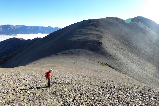
Conscious of the need to keep moving (and the fact that my fingers were frozen) we packed up and headed across the ridge towards Blacksmith Spur. Plenty of gunshots echoing around the valley - hopefully our mates had got onto their target species!

Looking back along the ridge to Coal Hill

The ridge has about 280m of vertical included but we made good time and were on the next summit 30 minutes early at 12:30 pm local. A convenient boundary fence post supported the antenna and we were away again with plenty of contacts back to Christchurch on 2m and NZ and Australia on 40/20m. 

Mt Cook, Mt Tasman and friends from Blacksmith Spur

We chose our operating positions on both summits to ensure we were inside the Mt Peel/Waikari Hills Conservation Area ZLFF-0022 and it paid off as we worked a number of VK stations chasing the WWFF reference which adds to the enjoyment. 

6m pole bungeed to the post 44' doublet antenna and open wire feeder.

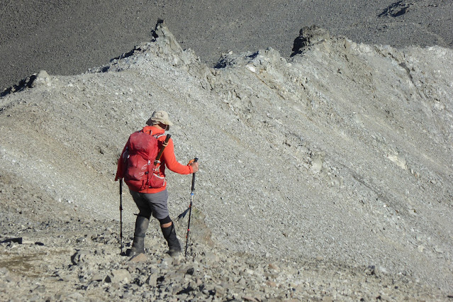
Conscious of Mark's warning about the state of the return track down through Rawle Gully, we grabbed a bite of lunch and set off down. The first part is straightforward, follow the park boundary fence down the spur towards the gully. The last bit is near-vertical and, combined with wet grass and mud, very slippery. Both of us ended up on our backsides and ended up holding onto the fence most of the way down!

Hanging on to the fence was a good option down here...

The entry point into the riverbed is well marked but poles are a bit sparse after that and after some bush bashing, we found the markers again just before arriving at the exit point and our ride home! It's a good 2 hours down from the summit.

A really good day out. 12 points in the bag, 12km and 1360m of vertical into the legs.

Getting there: Past Peel Forest and into the Rangitata Gorge Road. Drive past two "Z" corners and along a straight to the Coal Hill track start (DOC Sign). -43.755163 171.159353

Climb is 2 hours to Coal Hill (DOC sign says 3 hours), 3.2km and 1074m vertical gain.

Ridge to Blacksmith Spur is 1 hour 15 minutes, 4km and 276m vertical

Descent from Blacksmith Spur to Rawle Gully bridge took us 2 hours (wet), 4.6 km and 992m descent

Cell reception is patchy on both summits. Sometimes 4G and sometimes not even SMS.


Thursday, 21 April 2022

Castle Hill Peak ZL3/CB-241 18 April 2022

This is a peak I have been building up to for some time and finally it all came together on Easter Monday - good weather, Dave back from holiday and me nicely warmed up with a steady run of activations under my belt.

We arrived at the start point - the top of Porters Pass on SH73 at 7:45am to find 10 cars there already... Briefly considered changing to Hamilton Peak but decided to stick with our plan and hope that the others were only going as far as Foggy Peak. As it turned out, that was a good decision.

Packs on and we were off with Dave warning me to pace myself (I have a bad habit of starting out too fast) as we headed up Foggy Peak to the first waypoint. The first part of the route is now poled - presumably to guide walkers down the correct spur when Foggy Peak lives up to it's name. Soon the poles gave way to a well trodden but unmarked route up the hill. Over a ripper of a false summit and then up onto Foggy Peak itself - 1 hour to the top and we have overtaken the first pair of climbers. So far so good. A quick stop to admire the always-inspiring sight of Mt Cook in the distance and off we go again, dropping down 80 vertical metres into a saddle with a large rock arrow that has been turned into a sculpture of a man - very clever.

Heading down the saddle "Rocky" at the bottom and our destination top right...

From here it's a steady climb along the main ridge towards our destination, the highest peak in the Torlesse Range and Korowai Torlesse Tussockland Park. Along this stage we met two climbers on their way down already.

The razorback ridge across to the final climb is a little intimidating but just keep your head down Geoff, be sure of your footing and across we go. Dave wants to come back here and do it again in winter - madness! 

Ridge negotiated and up the final steep climb to the top - motivation levels high and feeling pretty good. We met another bloke heading down the steep, slippery part here, looking good for having the summit to ourselves!

Before too long we arrive at a spectacular summit marked by a rather beaten-up trig - 2 hours 40 minutes, very happy with that.


Looking across the top of Mt Lyndon, Red Hill and Peak Hill to Mt Cook (centre back)

As usual, we were about 45 minutes early so got everything set up and ready to go. Antenna of the day was the 44' doublet (40-10m), a firm favourite and Mark ZL3AB had warned us there wasn't much room on the top. The pole was bungeed to a convenient waratah and we were in business.

Checking the doublet, view towards Christchurch

Dave started on 40m SSB with a big pileup while  I worked the locals on 2m FM. Switching to 20m CW everything sounded a bit flat but I worked a few VK regular Chasers plus a few who were clearly hunting us for the ZLFF-0027 WWFF park reference. I worked my way up the bands but no DX today - it turns out there had been an M4 Solar Flare just as we arrived on-summit! We made Summit-to-Summit contacts with Philip ZL1PSH (40m SSB+CW) and Richard ZL4FZ on Mt Iron. While Dave caught up with a few VKs on 20m SSB, I spotted more climbers heading across the ridge so we decided to pack up, have lunch and leave the summit to them. Timing was perfect, they arrived as we finished our lunch so after a brief chat about their intentions, Dave took photos for them and off we set.

The trip down was slippery but uneventful - walking poles are an absolute must-have for this one. As we descended the slopes of Foggy Peak, the cloud was rolling in and, once back at the car, the whole mountain was living up to it's name - covered in cloud.

A great trip - my highest mountain to date at 1998m and a real highlight of my SOTA journey.


Getting there: Park at the top of  Porters Pass SH73, head straight up Foggy peak!

Permission: not needed, Korowai-Torlesse Tussocklands Park

Time to top: 2 Hours 37 minutes with stops to chat to others and take photos

Cell/4G: Solid coverage on Spark/Skinny at the summit

Sunday, 10 April 2022

ZL3/CB-551 Russell Range (West)

 I don't normally write more than one blog for a summit but this one deserves it. As my climbing buddy was away, I decided to head back up to Russell Range  to try a new (for me) antenna configuration and check out the alternate descent route documented by Mark ZL3AB a few weeks ago. Anything that's easier on the knees is fine by me!

It's a nice enough 1 hour 40 minute (7km, 681m vertical gain) walk up a farm track to the summit. A beautiful autumn morning saw me shivering on the first bit but I soon warmed up as the elevation increased! For the first time in four visits, I met another person on the track, a hunter heading up on his quad bike (slightly jealous). Before long I was at the now familiar summit activation zone (the easement track runs through it) and got my requisite 4 contacts quickly on VHF (2m). As I was early, I tried UHF (70cm) and worked Ken ZL3OC in Timaru with strong signals. Jim ZL3ND popped up again so we worked on Fusion (C4FM), Jim using his handheld in the backyard. What was a scratchy FM contact became rock-solid audio when we switched to Fusion.

As my KX2 is still at the doctors, the little homebrew MTR3B (5 Watts CW-only) and trapped End Fed Half Wave (EFHW) were used. I usually rig this antenna as an Inverted V with the top of the pole close to the middle of the wire. I decided to try the inverted L configuration this time - theory being that getting the first section nearly vertical should improve low angle radiation on 20m - where the DX hangs out!

MTR3B, Tuner and tiny 450mAH LiPo

Trapped EFHW showing near-vertical first section. Track markers have many uses!

I worked the local ZLs on 40m with good signals. It was nice to work Philip ZL1PSH again from his Manukau Heads summit ZL1/AK-014. He's really getting the hang of this CW lark! Moved up to 30m and called CQ for 10 minutes - crickets... I was just about to switch to 20m and then John ZL3MR called me from Mount Barrosa ZL3/CB-499. Nice!

The antenna theory worked (or was it just a happy coincidence?) as, when I switched to 20m I had a nice pileup of VK stations and in amongst the pile, I heard "OH1". Responding "OH1?" I was thrilled to hear Pasi OH1MM calling me with a good signal in the clear. We exchanged reports and completed the contact, amazed that I was working Finland with 5W and a bit of wire -that's 17223 km!

As I was heading out the long way, I packed up HF about 11:30am and settled down to eat. With that the hunter I saw earlier came back down the track and stopped to chat. He asked the usual questions about what I was doing and seemed suitably impressed. Off he went down the steep, slippery track on his quad (I would rather be walking down...) and I had my lunch, listening to the stags roaring over in the Thirteen Mile Bush. Caught up with the locals on 2m after UTC rollover and was pleasantly surprised to get a call from John on 2m from Mount Barrosa. A bit scratchy but good enough - even with Mount Hutt right between us!


I headed down at 12:15pm local time with a big smile on my face - a very successful activation behind me and looking forward to the alternate descent route. 

It was exactly as Mark described, a very nice walk through Beech forest down the spur to the Benmore Hut. Rough and lots of windfall in places to add to the challenge of staying on the track but OK. Still plenty of wasps about so be careful if off the track... 

Nice dappled-light section soon after entering the bush at the top

Once down at the Benmore Hut junction, you turn right and follow a well marked )and well pest-trapped) track back down to the Annavale Track junction and back out to the car. This section is pretty boggy in places and you cross a few streams, waterproof boots are a plus!

A much more interesting route than coming back down the farm track, this will be my default descent route for future activations of this very nice summit. It's an extra 2 km and 107m of climbing but well worth it. 2 hours 15 minutes from the summit to the car for me this way.

Thanks to all the Chasers and fellow Activators, local and DX - every call is appreciated!